About Exeter Drone Surveys
Drone pilots with a construction background — we understand roofs, not just flying.
Built on Construction Experience
Exeter Drone Surveys was founded on a simple observation: most drone survey companies are run by photographers or tech enthusiasts who learned to fly a drone, but don't really understand what they're looking at when they inspect a roof.
We come from the opposite direction. With years of hands-on experience in the construction and groundworks industry across Devon, we understand building structures, roofing materials, drainage systems, and what constitutes a genuine structural concern versus normal weathering.
When we spotted the potential for drone technology to make roof inspections safer, faster, and more thorough, we invested in the best equipment available and combined it with the construction knowledge that makes the difference between a pretty photo and a genuinely useful survey report.
That's our edge. Your drone survey report isn't written by someone who just learned what a ridge tile is. It's written by someone who's worked with them.
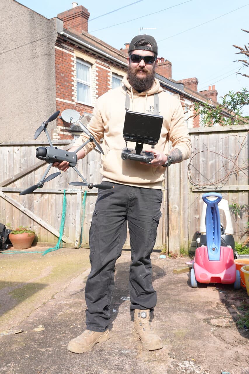
The Operator
CALLSIGN: SPARKSam Hembury has spent most of his life on construction sites — from digger operator and groundworker to site supervisor, manager, and running his own contracting business, Hembury Contracting. He understands the built environment from the foundations up.
But it's not just construction. Sam served in Ukraine under the callsign SPARK, where he trained with drone systems and learned firsthand what they're capable of. He also knows what it's like to be on the receiving end — hunted by enemy drones for over an hour on the front line, alone, with impact grenades and mortars dropping around him. Someone was looking over him that day — he walked away without a scratch.
That experience gives a different perspective on drone technology — and translates directly into the precision, discipline, and attention to detail you'll see in every survey report. Nothing gets missed.
Professional Equipment
Two specialist drones for comprehensive aerial survey capabilities.
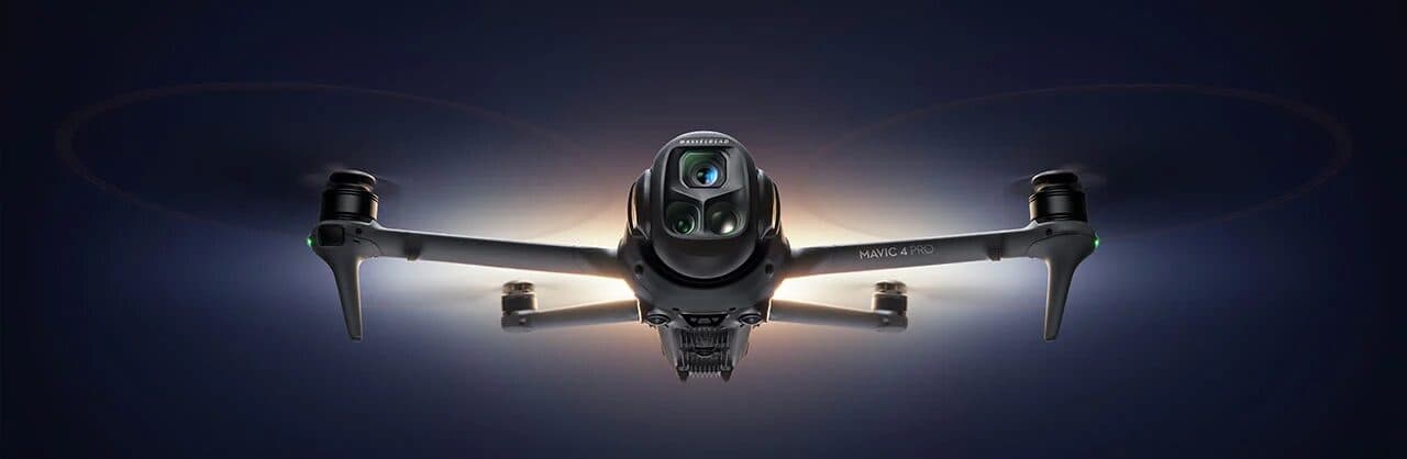
DJI Mavic 4 Pro Creators Edition
Our primary survey drone. The 100MP medium format Hasselblad sensor captures detail that standard 12-20MP drone cameras simply cannot match — sharp enough to identify hairline cracks in individual tiles.
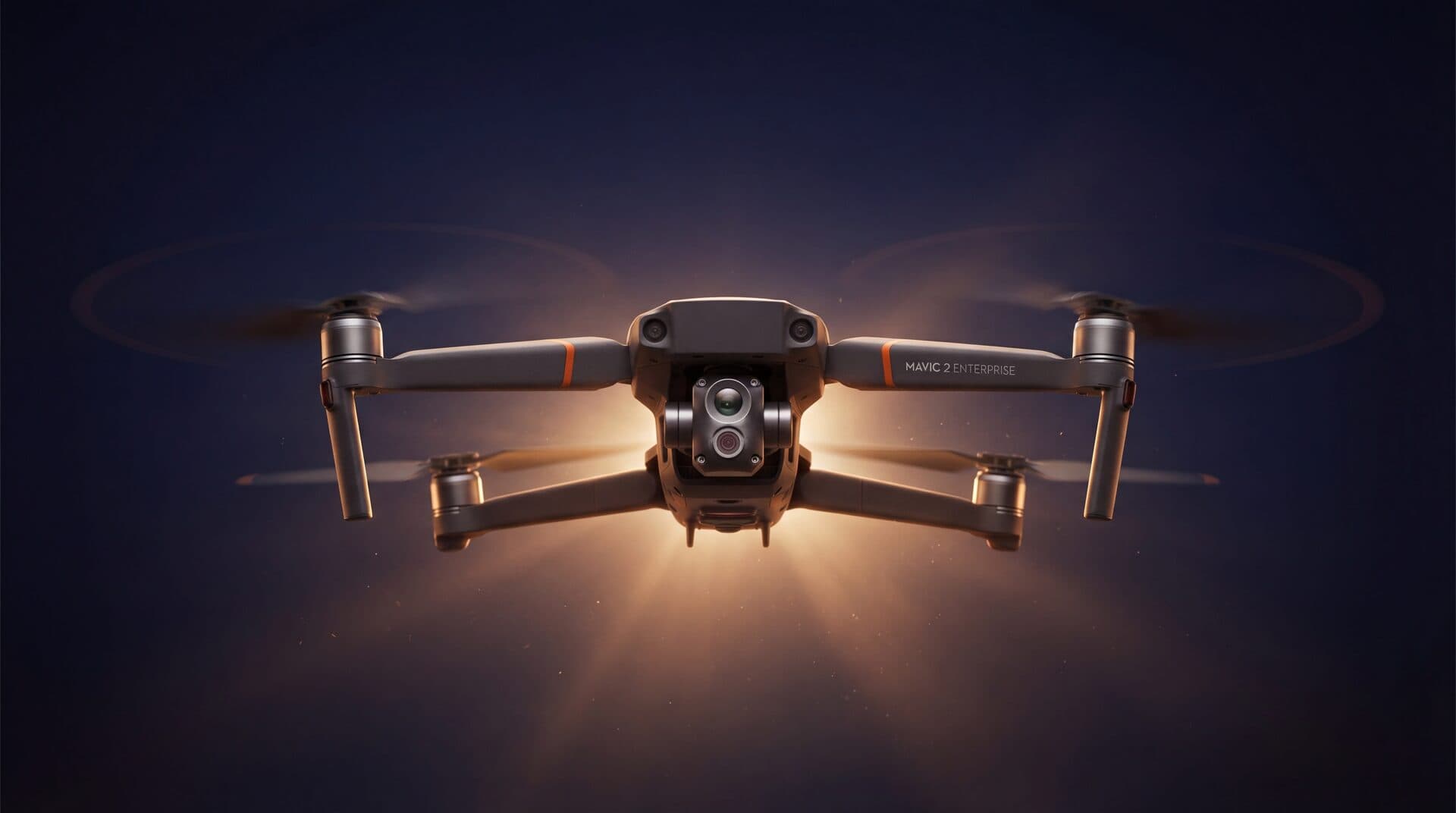
DJI Mavic 2 Enterprise Advanced
Dedicated thermal imaging platform for detecting heat loss, moisture ingress, insulation gaps, and hidden leaks invisible to the naked eye. Dual-sensor overlay maps thermal data onto visual imagery.
Qualifications & Compliance
Fully registered, insured, and compliant with all UK drone regulations.
Ready to Book Your Drone Survey?
Get a detailed aerial inspection of your roof without scaffolding, ladders, or risk. Contact us today for a free, no-obligation quote.